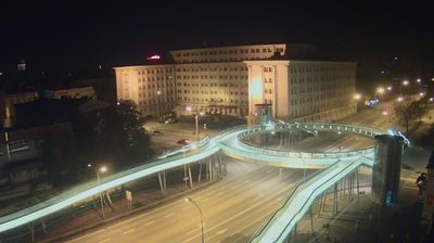
Stalowa Wola › เหนือ: City Park Shopping Mall - Generała Leopolda Okulickiego
![]() Stalowa Wola, ประเทศโปแลนด์
Stalowa Wola, ประเทศโปแลนด์
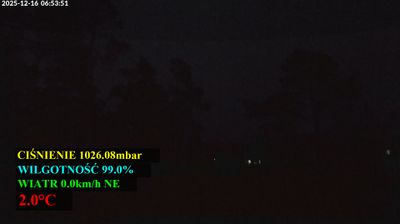
Real-Time Environment
Welcome to the live streaming webcam for Stalowa Wola › เหนือ: City Park Shopping Mall - Generała Leopolda Okulickiego, perfectly situated in the vibrant region of Stalowa Wola, ประเทศโปแลนด์. Watching this live camera allows you to instantly experience the local atmosphere and monitor current climate conditions.

About Stalowa Wola
Stalowa Wola is the largest city and capital of Stalowa Wola County with a population of 58,545 inhabitants, as at 31 December 2021. It is located in southeastern Poland in the Subcarpathian Voivodeship. The city lies in historic Lesser Poland near the confluence of the Vistula and the San rivers, and covers an area of 82.5 km2 (31.9 sq mi).
📖 Read more on Wikipedia📍 Location Facts
-
Country
 ประเทศโปแลนด์
- Region województwo podkarpackie
- City Stalowa Wola
- Coordinates 50.5681°N, 22.0582°E
Have you been to Stalowa Wola?
Help the community! Share your experience, tell us about the weather, or upload your own photos from this exact location.