Salmon Arm › ตะวันออกเฉียงเหนือ: Shuswap Regional Airport (CZAM)
![]() Salmon Arm, ประเทศแคนาดา
Salmon Arm, ประเทศแคนาดา
Real-Time Environment
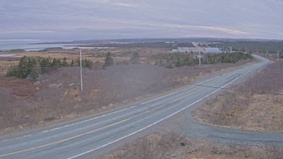
Welcome to the live streaming webcam for Salmon Arm › ตะวันออกเฉียงเหนือ: Shuswap Regional Airport (CZAM), perfectly situated in the vibrant region of Salmon Arm, ประเทศแคนาดา. Watching this live camera allows you to instantly experience the local atmosphere and monitor current climate conditions.

About Salmon Arm
Salmon Arm is a city in the Columbia Shuswap Regional District of the Southern Interior of the Canadian province of British Columbia that has a population of 19,432 (2021). Salmon Arm was incorporated as a municipal district on May 15, 2005. The city of Salmon Arm separated from the district in 1912, but was downgraded to a village in 1958. The city of Salmon Arm once again reunited with the District Municipality in 1970. Salmon Arm once again became a city in 2005, and is now the location of the head offices of the Columbia-Shuswap Regional District. It is a tourist town in the summer, connected to all 4 arms of Shuswap Lake, with many beaches, numerous golf courses, camping facilities, and house boat rentals. Salmon Arm is home to the longest wooden freshwater wharf in North America.
📖 Read more on Wikipedia📍 Location Facts
-
Country
 ประเทศแคนาดา
- Region รัฐบริติชโคลัมเบีย
- City Salmon Arm
- Coordinates 50.6838°N, -119.2317°E
Have you been to Salmon Arm?
Help the community! Share your experience, tell us about the weather, or upload your own photos from this exact location.